Wondering where on Earth you’re allowed to run?
When course checking at the recent Original Buckinghamshire, it struck me that footpath signs aren’t the most useful things in the world and, without marked races, participants can practise and train if they are new to stepping off the tarmac.
One of the biggest barriers to trail running is navigating. Whilst being a map geek since the early days of scouting and the air training corps, I would advocate using them. I’d fully recommend the OS Maps app, with an annual subscription below the £30 mark, it’s rapidly becoming a vital tool in my trail running toolkit. But, In the age of Strava and a plethora of routes out there, why bother with maps?
As well as engaging runners in their area, such as finding points of interest from Victorian isolation hospitals to neolithic standing stones and burial chambers, they can help us know where we are allowed to go. This is super important when using the countryside in a responsible way. It may be our playground, but it is also a place where people make their living. It’s not common knowledge that pretty much all land within the UK is owned by somebody.
Here are a few tips.
In the extract below, Open Access Land is shaded in yellow-orange on an Ordnance Survey (OS) map, where one can, legally, wander anywhere. If the land is coloured white, you must be on a right of way. Whilst there are many arguments about the right to roam and trespass, this is really important to protect farmers livelihoods. The orange dots indicate a cycle path.
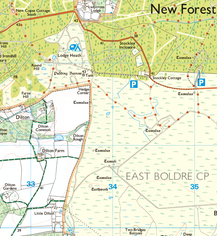
In the next extract, you can see that ‘Open Access Land’ is sometimes hard to come by!
Then there are the range of rights of way. I recommend using the excellent OS Maps app. A little bit of knowledge can lead to a more rewarding run. For example:
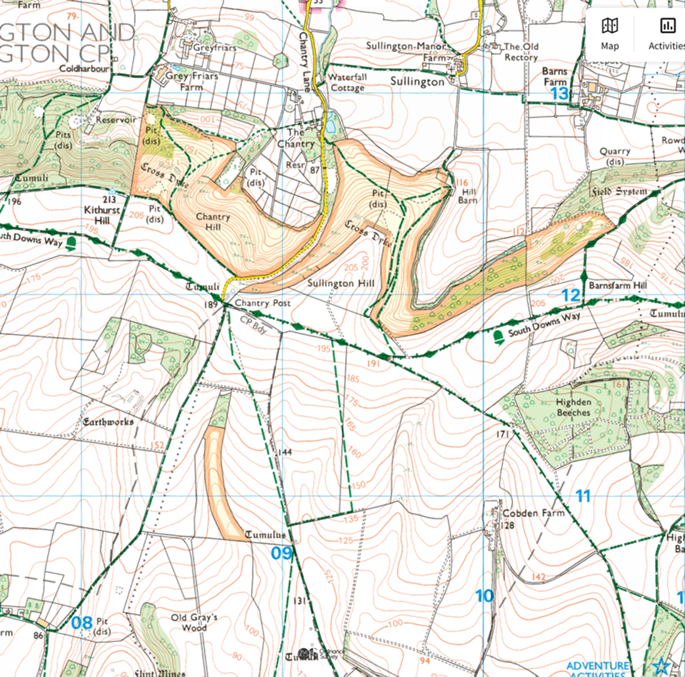
This is a 1:50,000 map. Pink lines are legal rights of way; black dashes are physical paths. The problem with this scale of map is that the open access land is not always marked, and not all rights of way are paths that can be seen.
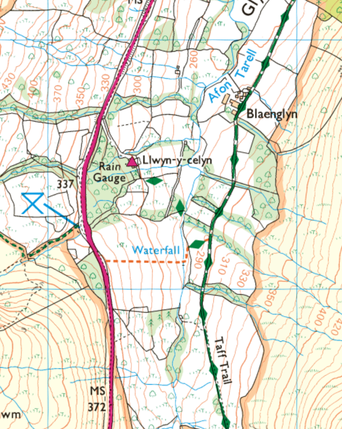
Below is a 1:25,000 map extract. Confusingly, rights of way are shown as green lines, although physical paths remain in black. Orange lines (shown below, just south of the words ‘waterfall’) are permissive paths where the landowner has given permission to cross. Unlike legal rights of way, these can be closed at any time, without a diversion in place, for example during lambing season. What do you notice about this one? Would you expect to see a path?
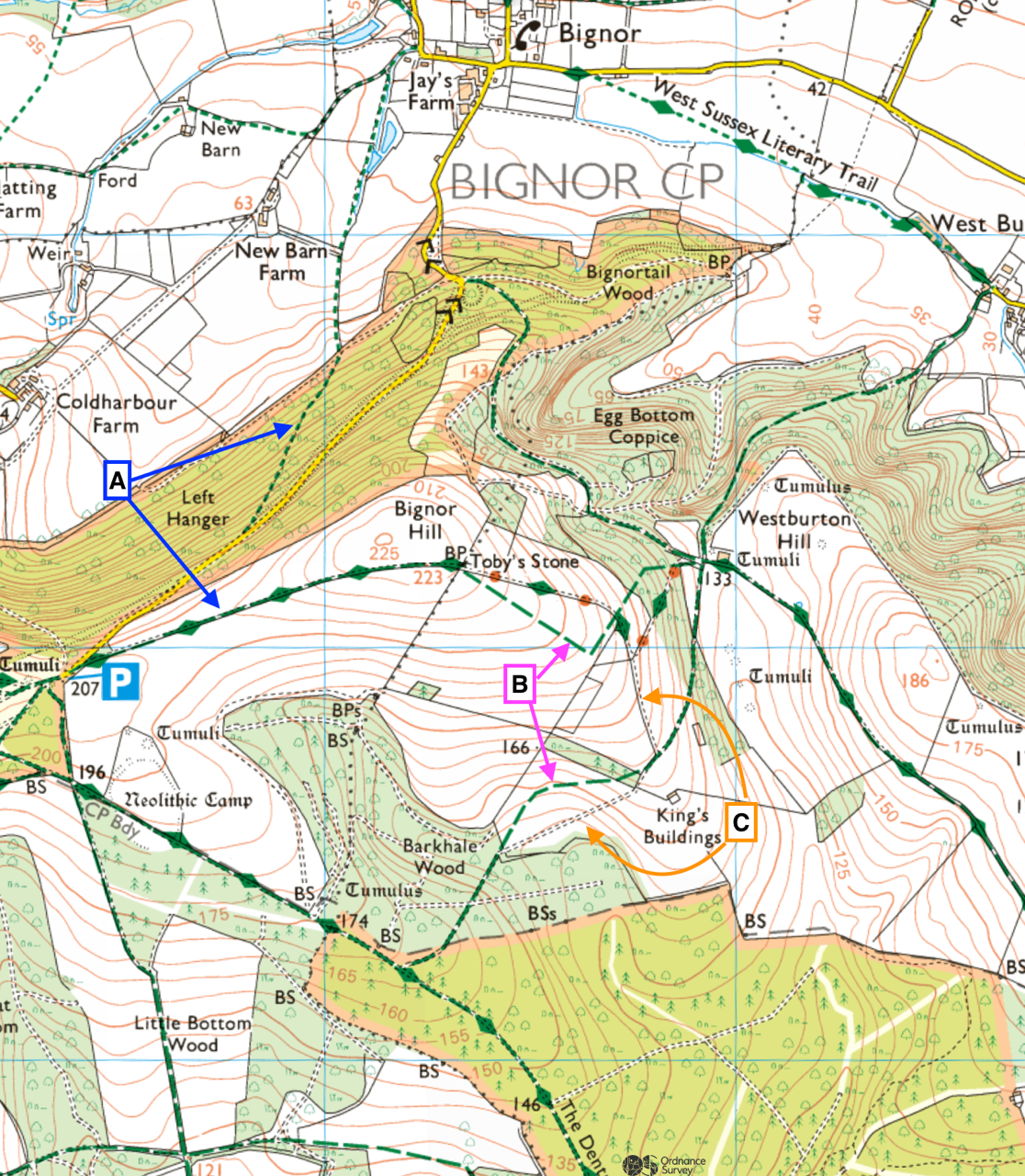
The main rule to remember is that any sort of green line is good to legally be on.
‘A’ shows a black line under the green, meaning there is a physical path to see & follow.
‘B’ is an example of a right of way WITHOUT a black line, meaning, although we are allowed to bimble along it, there is no a physical path to see.
‘C’ is an example of a black line without a green. This means that there is a physical path but, as the land is not open access, this situation is interesting. Most likely it’s locally accepted to be moving along the path, as it follows a better line.
If in doubt, remember that eyes were invented before maps: look for signs, stiles and gates.
David Rogers is one of our Maverick Run Project leaders. He keeps a blog about his own running adventures so if you fancy a read, head on over: Mtn & Trail Adv.